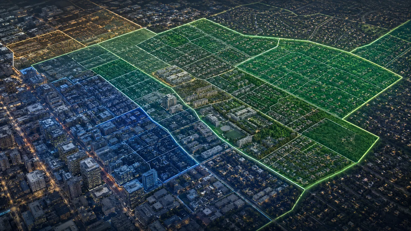
Endpoint-aware inputs with readable JSON and parsed responses on the homepage.
From any location
to verified property intelligence.
Now inside your AI.
Get API access from $79· Published limits · No base-tier sales gate
PropData is one property and geospatial intelligence layer for every way your team builds. Start with an address, parcel ID, or coordinates. Resolve the property against a 166M+ indexed U.S. parcel foundation, return verified geometry where available, and attach ownership, valuation, tax, sale, comps, rent, market, risk, and location context. Call it through REST—or connect the same PropData account to Cursor, ChatGPT, Claude, and other MCP clients. Use standard routes, bulk workflows, or commission a custom endpoint shaped around your product.
The product makes the case.
Run distinct schemas, inspect provenance, connect an AI client, and see pricing before a sales call. PropData is positioned as infrastructure builders can evaluate directly—not a dashboard promise.
Use the same PropData account in Cursor, ChatGPT, Claude, REST, and other MCP clients.
Property, geometry, comps, market, rent, risk, usage, changelog, and custom contracts.
Published monthly limits and upfront pricing—no contact-sales gate for base access.
Start at $79.
Go live without waiting on sales.
Choose monthly or annual access below and continue directly to secure Stripe checkout. Every plan includes production REST access, the customer-safe MCP connector, and the interactive workspace. Your API key activates immediately after payment.
- 10,000 requests each month
- 20+ property, market, rent, comps, and risk routes
- REST, workspace, and customer-safe MCP access
- Address, parcel ID, coordinate, and geometry workflows
- 50,000 requests each month
- Everything in Starter plus
enrich=full - Historical, geospatial, and AI-ready workflows
- Priority support and priority county coverage requests
- 250,000 requests each month
- Everything in Builder plus bulk and batch workflows
- Higher-volume API, geospatial, and agent operations
- 10 API keys with email and Slack support
- Unlimited requests and API keys
- Everything in Scale plus white-label rights
- Custom endpoints, responses, and coverage planning
- Direct onboarding and founder-level implementation
One data layer.
Every place your team builds.
PropData is no longer limited to code calling an endpoint. Developers can use the same production account inside Cursor. Teams can connect compatible ChatGPT, Claude, and MCP clients. Applications can keep using REST, bulk, and custom contracts. The intelligence, account controls, and usage plan stay unified underneath.
Build with live property tools inside Cursor.
Let Cursor resolve properties, compare markets, inspect comps, estimate rent, and use neighborhood intelligence while it writes your application.
ADD PROPDATA TO CURSOR →Bring verified property context into AI workflows.
Use customer-safe tools instead of pasting raw API responses or asking an assistant to infer property facts from unstructured pages.
VIEW CONNECTION GUIDE →Give agents a constrained property toolset.
Expose narrowly defined lookup, market, comp, rent, and neighborhood functions with explicit coverage and match status.
VIEW MCP DOCUMENTATION →Keep complete control inside your product.
Call the API directly, run bulk workflows, request custom response contracts, or embed PropData invisibly beneath your own interface.
EXPLORE ENDPOINTS →{
"mcpServers": {
"propdata": {
"url": "https://propdata-mcp.sales-fd3.workers.dev/mcp"
}
}
}
The public connector exposes customer-safe property and market tools. It does not expose PropData’s internal county imports, canonical files, checkpoints, infrastructure credentials, deployment controls, or private QA systems.
Everything needed to evaluate
and integrate the API.
The full PropData API Reference & Integration Guide documents authentication, property and market routes, coordinate-to-parcel resolution, parcel geometry, ?enrich=full, comps, rent, neighborhood and risk context, MCP workflows, usage, errors, and implementation examples.
The API is the product.
The OS is the operating proof.
PropData is backed by a live real estate operating system that discovers official public infrastructure, validates jurisdiction and schema fit, publishes trusted intelligence, monitors customer-priority coverage lanes, and revisits known data to detect change.
We do not freeze operating metrics into this homepage. Open the live OS to see current aggregate production, geography, publishing, refresh, field-classification, quality, and priority-lane activity.
Six states. Twelve counties.
Fifteen exact parcel boundaries.
Select a verified parcel from Florida, Michigan, New York, Minnesota, Nevada, or North Carolina. Every option preserves its real county identifier and official polygon—no generic pins, placeholder IDs, or fabricated nationwide examples.
The dashboard shows it.
The API powers it.
PropData is not another property-search dashboard. It is a programmable property and geospatial intelligence layer designed to sit underneath real estate, mapping, appraisal, insurance, solar, roofing, construction, field-service, site-selection, and AI products.
Explore production endpoints →Start with what your product already has.
Address, official parcel ID, or latitude and longitude. PropData resolves the county, canonical parcel identifier, and matching property record.
GET /v1/property/by-location?lat=&lng=
Return the parcel, not just a pin.
Use GeoJSON boundaries, centroids, and bounding boxes for click-a-parcel selection, overlays, acreage analysis, site planning, and spatial intersections.
GET /v1/parcel-geometry
Collapse multiple vendors into one call.
Attach ownership, valuation, taxes, sales, characteristics, comps, rent, flood, hazard, neighborhood, affordability, and risk context.
?enrich=full
Deliver it in the shape your system needs.
REST endpoints, MCP connectors, bulk workflows, delta feeds, white-label infrastructure, custom endpoints, and custom response shapes.
REST + MCP + BULK + CUSTOM
America, resolved.
One national property intelligence layer.
PropData is the independent data infrastructure beneath serious real-estate products. Resolve any property from an address, parcel ID, or coordinates—then add ownership, valuation, tax, sales, geometry, comps, rent, market, neighborhood, hazard, and investment intelligence through one platform.
Replace fragmented vendors and brittle joins with one production layer built for property search, underwriting, mapping, automation, and AI.
166M+ parcel records.
Four distinct coverage layers.
The parcel index is a major part of the value and should be visible. It is not, however, a blanket claim that every county publishes the same fields or that every parcel has verified geometry. PropData separates each layer so developers can understand exactly what is available for their workflow.
Nationwide ZIP, state, and metro context
Rent benchmarks, listing velocity, inventory, affordability, demographics, appreciation, mortgage context, hazards, and market signals.
NATIONWIDE LAYER166M+ indexed property and parcel records
The national foundation for addresses, official parcel identifiers, county routing, ownership, values, tax and sale fields where the official source publishes them.
50-STATE FOUNDATIONCounty-specific production validation
Exact-ID crosswalks, source-schema validation, row reconciliation, null preservation, duplicate checks, and repeated property-to-enrichment gates.
Map point to parcel boundary
County routing, point-in-polygon matching, GeoJSON boundaries, centroids, bounding boxes, and spatial workflows expanding through verified markets daily.
Coverage is not a checkbox.
It is an engineering system.
County data is fragmented by jurisdiction, schema, identifier format, and GIS design. PropData routes each market through an official-source workflow and publishes verified coverage only after the full location-to-parcel-to-enrichment chain holds up in production.
null. A legitimate zero remains zero. Provenance, source identifiers, retrieval context, and deliberately empty fields can travel with the record.
Locate the official source
Assessor, tax, public-record, and GIS systems are identified and validated at the county level.
Canonicalize exact identifiers
Leading zeros, punctuation, alternate parcel IDs, and assessor-to-GIS crosswalks are preserved and tested.
Resolve points against geometry
Latitude and longitude are routed to the correct county and matched to parcel boundaries with point-in-polygon logic where configured.
Reconcile the whole county
Row totals, duplicates, geometry, null behavior, source fields, and geographic canaries are audited before release.
Repeat live production gates
Address, parcel-only, coordinate, geometry, and full-enrichment workflows are tested repeatedly. Uncertainty is quarantined, not guessed.
Every miss reveals where the network
should become stronger next.
Most static databases treat a miss as the end of the request. PropData treats it as structured coverage intelligence. We preserve the safe API response while turning repeated county, workflow, and field-level gaps into an evidence-backed expansion queue.
When a source does not support a field or a county workflow has not cleared production gates, the API returns a truthful status, source context, and nulls—not invented values.
coverage_status: "not_configured"
annual_tax: null
source_provenance: preserved
The unsupported county, missing route, failed crosswalk, geometry gap, or incomplete enrichment chain becomes a structured work item that can be ranked against real customer demand.
county + endpoint + failure stage
→ source investigation
→ verified production coverage
Capture the exact failure stage
Address, parcel ID, coordinates, geometry, assessor join, or enrichment.
Rank by customer and market demand
Builder+ requests and repeated production gaps inform the active queue.
Locate the official county systems
Assessor, tax, public record, GIS, and exact source schemas.
Preserve identifiers and joins
Leading zeros, punctuation, alternate IDs, geometry links, and null behavior.
Run countywide and live gates
Row reconciliation, duplicates, canaries, point-in-polygon, and repeated chains.
Promote reusable infrastructure
The repaired route improves every future customer using that market.
Need coordinate resolution, geometry, assessor enrichment, or a custom field set in a specific county? Builder, Scale, and Enterprise customers can submit priority markets. Approved requests are reviewed against source availability and moved into the active engineering and QA queue.
Real customer workflows are shaping the infrastructure.
A national real-estate platform needed a dependable coordinate → parcel → assessor → full-enrichment chain across a multi-state, dozens-of-counties rollout. That requirement drove county-specific routing, exact-ID crosswalks, geometry resolution, live canaries, repeated production gates, and a much stronger product for every future mapping customer.
Official property records.
Market, risk, and geospatial layers.
One API.
PropData combines a 166M+ record U.S. parcel index across 50 states with direct county assessor and GIS records, market, rent, demographic, economic, flood, hazard, safety, and proprietary intelligence layers. The national parcel foundation matters—but the larger value is resolving a location to the correct parcel, returning verified geometry where available, and attaching the context your application needs without stitching together separate providers.
Fair Market Rents
The government's official rent benchmark — the same data used to set Section 8 voucher amounts. Every county in America. Studio through 4-bedroom. Ground truth for affordability analysis.
Observed Rent Index
ZORI — Zillow's smoothed median asking rent for all homes and multifamily. The most cited rent trend dataset in real estate. ZIP, metro, state, and national with 10 years of history.
Market Metrics
Monthly listing data: median prices, days on market, active inventory, new listings, price reductions, price per sqft. The pulse of the for-sale market at ZIP level.
Market Tracker
Sale-to-list ratio, % sold above list, days to pending, months of supply. The sharpest demand signal in public real estate data.
ACS Demographics
Vacancy rates, renter %, median income, rent-to-income ratio, poverty rate, unemployment. Affordability context nobody else includes at this price point.
FRED Macro Data
Mortgage rates, shelter inflation, national vacancy rate, and housing starts. National economic context alongside local market data.
House Price Index
Quarterly home price appreciation by state and metro. The definitive government measure of home value change — used by mortgage lenders, Fed economists, and institutional investors.
Building Permits
Monthly new construction by unit type. The forward-looking supply signal — permits today become inventory in 12-18 months. Predicts rent pressure before it shows up in listing data.
PropData Estimate Engine
Weighted rent estimate model built on owned data. ZORI (40%) + Census ACS (25%) + HUD FMR (20%) + Redfin cap rate (15%). Returns low/mid/high range with confidence score. No third-party dependency.
County Assessor + GIS Records
Direct-ingest property and parcel records from official county assessor, tax, public-record, and GIS systems. Ownership, situs and mailing addresses, valuation, taxes, sales, characteristics, official identifiers, and parcel geometry where configured. Coverage is verified county by county and expands continuously.
Comps Engine
Comparable sales engine built on our 166M+ parcel database. Ranked comps scored on price, sqft, recency, and bedroom count. Low/mid/high range + avg price per sqft. Delivered through the same API workflow.
Geospatial Resolver
Resolve addresses, coordinates, ZIP codes, county FIPS, and official parcel identifiers through one routing layer. Coordinate workflows can match a map point to the underlying parcel and continue directly into geometry and enrichment.
Natural Hazard Risk Index
18 natural hazard risk scores by county — wildfire, flood, hurricane, tornado, earthquake, hail, heat wave, drought, winter weather, and 9 more. Per-capita annualized loss rate percentiles so you're not comparing Maricopa County to rural Kansas unfairly. The same dataset FEMA uses to allocate disaster preparedness funds. Visualized on a live US heat map. Now inside your API call.
Community Safety Score
Composite A–F grade combining school quality (100K+ schools), poverty, unemployment, social vulnerability, resilience, and crime. A combined due-diligence layer for software and underwriting workflows.
Opportunity Zones + USDA Rural
Every ZIP in America flagged for federal Opportunity Zone designation and USDA rural loan eligibility. OZ investors defer capital gains taxes. USDA eligibility means zero-down financing. Two filters that change deal structure entirely.
FEMA Flood Hazard + Skip Trace
FEMA National Flood Hazard Layer flood zone per property — Zone A, AE, X — mandatory insurance baked in. Skip trace returns owner phones, email, and equity data. Microsoft ML building footprints add sqft and height per structure.
The same data powers these platforms
Source ingestion.
County routing.
Edge API delivery.
PropData separates source ingestion, county routing, canonical storage, verification, caching, authentication, and API delivery into dedicated infrastructure layers. Official county records and supporting market sources refresh on source-appropriate schedules, while validated responses are delivered through the Cloudflare edge.
PropTechUSA.ai Infrastructure
PropData runs on 10+ dedicated Workers inside PropTechUSA.ai's 200+ Worker production stack — the same infrastructure powering IntelligentHomeBuying, IntelligentLandlord, and LHBUSA. No monolith. Pure edge.
KV Edge Cache
All market data cached at Cloudflare's edge. 7-day TTL. Sub-50ms reads globally.
Supabase Canonical Store
15+ normalized tables. ZORI, Realtor, Redfin, HUD FMR, Census ACS, FHFA HPI — ZIP, state, and metro tiers. Indexed for fast queries.
API Key Auth + Rate Limiting
Tiered access: Starter 50 req/hr, Builder 500 req/hr, Internal unlimited. Keys provisioned in KV instantly on signup.
Six infrastructure layers.
One integration.
The dashboard demonstrates the response. Production teams integrate the API and select only the layers their workflow needs.
GET /v1/property?parcel=...&enrich=full
Return the core record, then attach tax, equity context, comps, rent, flood, hazards, neighborhood, affordability, risk flags, and investment scoring.
Rent, listing, demand, affordability, macro, FHFA, FRED, and investor signals
Zillow ZORI, HUD FMR by bedroom, rent trend, confidence, and source metadata
Median listing price, DOM, inventory, new listings, price reductions, and price per sqft
Low, mid, high rent range with confidence and methodology breakdown
Official parcel identifiers, ownership, situs and mailing addresses, valuation, taxes, sales, and property characteristics
Core property record plus tax, equity context, comps, rent, flood, hazard, neighborhood, affordability, risk flags, and investment scoring
Lat/lng to county/FIPS to point-in-polygon parcel match where GIS coverage is configured
GeoJSON boundary, centroid, bbox, source, and coverage status
Comparable records ranked by price, sqft, recency, beds, and location context
Address or ZIP lookup from PropData's own database
Demographics, housing, safety, schools, affordability, and hazard context
Market scores, vacancy, yield, unemployment, appreciation, and AI investment summary
BUY/HOLD/AVOID signal, friction score, top metros, risk index, and market trend context
Changed property records with cursor pagination
Active assessor coverage and county availability metadata
Owner contact, mailing address, equity, and lead status where available
Notice date, auction date, case number, lender, default amount, and assessed value
Updated foreclosure records with cursor pagination
Versioned endpoint additions, fixes, source updates, and MCP/AI connector releases
Live parcel count and API stats
Current key usage, tier, limits, and reset metadata
API status, version, source health, plan mapping, and freshness metadata
OAuth-protected connector for Cursor, supported ChatGPT and Claude workflows, and compatible MCP clients using each subscriber's own PropData key
One key.
Production JSON everywhere.
The homepage shows the product and its most important workflows. The full reference, authentication, schemas, coverage behavior, error handling, and examples live in the dedicated documentation and downloadable API guide.
# 1 · Coordinates → exact parcel + official boundary curl -sS \ "https://propdata-api-worker.sales-fd3.workers.dev/v1/property/by-location?lat=25.7689792&lng=-80.1903649&include_geometry=1" \ -H "x-api-key: pd_live_YOUR_KEY" # 2 · Exact parcel ID → full enrichment curl -sS \ "https://propdata-api-worker.sales-fd3.workers.dev/v1/property?county_fips=12086&parcel=0102100001060&enrich=full" \ -H "x-api-key: pd_live_YOUR_KEY" # 3 · ZIP → market + rent intelligence curl -sS \ "https://propdata-api-worker.sales-fd3.workers.dev/v1/market?zip=33131" \ -H "x-api-key: pd_live_YOUR_KEY"
/v1/propertyAddress or parcel lookup/v1/property/by-locationCoordinates to parcel/v1/parcel-geometryGeoJSON boundary?enrich=fullOne-call due diligence/v1/market · /rent · /estimateMarket, rent, and AVM/v1/comps · /neighborhoodComparable + location context/v1/property/deltaChanged-record delivery/v1/usage · /health · /changelogOperations + visibilitypropdata-mcpCursor, ChatGPT, Claude + MCPMore than parcels.
A complete property data layer.
Use only the endpoints you need, or combine them into a single property-intelligence workflow. PropData is designed to replace fragmented data plumbing, not merely add another dashboard to your stack.
/v1/property
/v1/geocode
/v1/property/by-location
/v1/parcel-geometry
/v1/property
?enrich=full
/v1/market
/v1/rent
/v1/estimate
/v1/neighborhood
/v1/zip-intel
/v1/state-intel
/v1/property/delta
/v1/preforeclosure/delta
/v1/changelog
REST + MCP + CUSTOM
The dashboard is a working demonstration of the data layer.
Use it to inspect responses, manage keys, monitor usage, and test workflows. Customer-facing products should call the PropData API directly.
Competitors sell a slice.
PropData sells the infrastructure.
The point of this comparison is not to celebrate six other vendors. It is to show what your team is still missing after buying only property records, only parcel geometry, only skip trace, only rental analytics, or an enterprise bundle assembled across several separate products.
Five contracts to build one property product.
Teams commonly stitch together separate vendors for property records, geometry, contact enrichment, rental analytics, risk, public records, and AI connectivity—then maintain the joins, keys, billing, licensing, and failure modes themselves.
One API. One OS. One roadmap.
Start from an address, parcel ID, ZIP, or coordinates. Resolve the property, draw the boundary, enrich the record, attach market and risk context, deliver it through REST, MCP, bulk, delta, webhook, or a custom contract—and watch the operating system strengthening underneath it.
Published request economics favor PropData.
Included requests per dollar at each provider’s first published paid monthly tier:
10,000 successful monthly calls.
Published self-service pricing and listed overages produce this benchmark:
What you still need after buying them.
Competitor names remain because buyers search for them. The sales story is the missing infrastructure PropData consolidates.
After RentCast
You have a polished property, AVM, comps, listings, and market API. You may still need county-verified parcel geometry, a public production OS, public-record intelligence, MCP, delta feeds, custom response contracts, and customer-prioritized county buildout.
After Regrid
You have a serious parcel and spatial layer. You may still need rent estimates, market and macro intelligence, comps, hazards, neighborhood context, public records, investment signals, and a unified property enrichment response.
After BatchData
You have strong owner contacts, compliance tools, address services, and monitoring. You may still need parcel boundaries, point-in-polygon matching, county assessor routing, market and rent layers, hazards, and the live OS that builds new jurisdictions.
After Mashvisor
You have investment and rental analytics. You may still need an independent parcel foundation, geometry, direct county records, public-record intelligence, MCP, delta delivery, white-label infrastructure, and custom endpoint engineering.
After ATTOM
You have a broad established property-data catalog. PropData offers transparent entry pricing, direct builder access, the live Real Estate OS, custom endpoints, a modern location-to-parcel chain, and customer-prioritized county work without starting from an opaque enterprise bundle.
After Cotality
You have an institutional property ecosystem with broad delivery options. PropData gives emerging and scaling platforms a lower-friction path to comparable workflow categories, public pricing, founder-level integration, custom routes, and visible production proof at os.proptechusa.ai.
Why PropData replaces more of the stack
7 PROVIDERS · 13 CAPABILITIESScroll horizontally to compare every column · Public materials reviewed July 25, 2026
| Capability | PropData | RentCast | ATTOM | Regrid | BatchData | Mashvisor | Cotality |
|---|---|---|---|---|---|---|---|
| Transparent paid entry plan | $79 / 10K | $74 / 1K | Plan dependent | Plan dependent | Contact sales | $129 / 500 | Contact sales |
| 166M+ independent U.S. parcel index | Yes | 150M+ properties | 160M+ properties | 160M+ parcels | Public count not stated | Analytics-led | Enterprise scale |
| Address + parcel ID + true coordinate-to-parcel | All three | Property + coordinate workflows | Lat/lon + radius | Point + radius + polygon | Geocode / reverse geocode | Not highlighted | Spatial products |
| Parcel geometry inside broader intelligence workflow | County verified + expanding | Not highlighted | Boundary products | Core geometry product | Not highlighted | Not highlighted | Core spatial products |
| Property + comps + rent + market + macro | One platform | Property + AVM + trends | Multiple products | Not rent / market led | Not core | Rental analytics core | Multiple enterprise products |
| Hazard + flood + neighborhood + affordability | Integrated | Not full stack | Separate products | Spatial context | Not core | Neighborhood analytics | Enterprise products |
| Public-record intelligence lane | Cases, violations, citations, enforcement | Not highlighted | Foreclosure / permit data | Not core | Permit / lien / monitoring | Not core | Broad public-record sources |
| Live public Real Estate OS | Operating in public | Not publicly offered | Not publicly offered | Not publicly offered | Not publicly offered | Not publicly offered | Not publicly offered |
| Visible customer priority lanes | Builder+ roadmap input | Not publicly offered | Not publicly offered | Sales / support | Not publicly offered | Not publicly offered | Enterprise roadmap |
| MCP + AI-agent tools | Live MCP | Not highlighted | Not highlighted | MCP server | MCP server | Not highlighted | Enterprise MCP |
| Delta + monitoring + webhook delivery | Delta feeds + custom webhooks | Not highlighted | Enterprise feeds | Batch delivery | Monitoring push | Not highlighted | Cloud delivery |
| Custom endpoints + customer JSON contract | Core product | Enterprise inquiry | Enterprise packages | Enterprise delivery | Sales-led workflows | Enterprise only | Enterprise delivery |
| Best fit | One integrated builder stack | Property / AVM API | Broad enterprise property data | Parcel / spatial specialist | Contacts / compliance specialist | Rental analytics specialist | Institutional data ecosystem |
PropData vs RentCast
PropData vs Regrid
PropData vs BatchData
PropData vs Mashvisor
PropData vs ATTOM
PropData vs Cotality
Stop paying six vendors to build one product.
Bring your current contracts, endpoints, required fields, counties, usage, and target response. We will show you what PropData can consolidate, where a specialist may still make sense, and what custom route would remove the most engineering work.
Your workflow should not bend
around somebody else's schema.
Custom endpoints are a core PropData capability—not a footnote. Qualified integrations can combine multiple source layers, rename fields, normalize property-type dictionaries, remove unnecessary payload weight, add customer-specific logic, or expose an exact response contract that drops into an existing product.
CUSTOM ROUTESOne endpoint for the complete workflow
Combine coordinate resolution, parcel geometry, assessor fields, comps, flood, rent, and risk into one purpose-built request.
RESPONSE SHAPESMatch your existing schema
Rename fields, flatten nested objects, map property types to ATTOM or internal dictionaries, and return only the fields your product consumes.
PRIORITY COVERAGESource the counties your customers need
Official-source discovery, county routing, canonical IDs, imports, geometry, reconciliation, and live QA can follow a qualified customer roadmap.
BULK + DELTAMove more than one property at a time
Bulk enrichment, changed-record feeds, scheduled exports, and integration-specific delivery patterns for higher-volume workflows.
MCP + AI TOOLSGive agents structured property tools
Expose narrowly defined tools for property, location, market, rent, comps, and risk instead of making an agent parse pages.
WHITE LABEL + WEBHOOKSShip PropData invisibly inside your product
White-label data infrastructure, event-driven updates, direct onboarding, and founder-level integration support.
Ask for the JSON you wish existed.
An appraisal product may want a single endpoint that begins with coordinates, resolves the parcel, maps the property type to its existing model, returns commercial fields and geometry, and excludes investor-specific signals. That can be the endpoint.
GET /v1/custom/appraisal-context?lat=&lng=
{
"parcel_id": "...",
"property_type": "COMMERCIAL_RETAIL",
"boundary": { "type": "Polygon" },
"owner": { ... },
"valuation": { ... },
"tax": { ... },
"sale_history": [ ... ],
"commercial_fields": { ... },
"source": { ... }
}
Bring your target counties, sample coordinates or parcel IDs, commercial property dictionary, required fields, expected volume, and preferred JSON shape. We will scope the standard routes, custom endpoint, and coverage plan around the real integration.
Pay for intelligence once.
Use it everywhere you build.
Every plan includes REST API access, the customer-safe MCP connector, and the interactive workspace for testing, key management, and usage visibility. Choose the request volume and integration depth your product needs. Annual plans save 15%+ and lock in your rate for 12 months.
- 10,000 requests/month
- Access to 20+ endpoint routes
- Customer-safe MCP access for Cursor and compatible AI clients
- Full market intelligence
- Neighborhood + FEMA data
- Address, parcel ID, and coordinate lookup
- Comps engine access
- Geocoding
- Coordinate-to-parcel resolution where configured
- Parcel geometry, centroid, and bbox where configured
- Live changelog + usage endpoints
- enrich=full - Builder+
- Historical data - Builder+
- 50,000 requests/month
- Everything in Starter
- enrich=full unlocked
- Full-enrichment workflows through REST and supported AI clients
- Tax, equity context, comps, rent, flood, hazard, neighborhood, and investment scoring
- Historical data
- Production coordinate-to-parcel workflows
- Parcel geometry workflows
- Priority county coverage requests
- Priority email support within 24 hours
- 3 API keys
- Slack support - Scale+
- 250,000 requests/month
- Everything in Builder
- Bulk and batch workflows
- Higher-volume API and AI-agent workflows
- Email + Slack support within 4 hours
- 10 API keys
- Higher-volume geospatial and enrichment workflows
- Priority issue review
- 99.0% uptime SLA
- Cancel anytime
- Unlimited requests
- Everything in Scale
- Direct Supabase access
- White-label rights
- 99.9% uptime SLA
- Direct founder access
- Unlimited API keys
- Custom onboarding
- Priority county sourcing and coverage engineering
- Custom endpoint and response-contract design
- MCP, AI-agent, bulk, webhook, and white-label support
Stop stitching property data together.
Resolve it once.
Most teams assemble separate parcel, assessor, rent, comps, flood, demographic, and risk providers—then own every join, schema mismatch, coverage gap, and failure path. PropData collapses that chain into one production contract.
{
"match": {
"input": "parcel_id",
"county_fips": "12086",
"match_level": "exact"
},
"parcel": {
"official_id": "...",
"geometry": {
"type": "Polygon",
"centroid": [ -80.23, 25.89 ]
}
},
"property": {
"owner": {},
"valuation": {},
"tax": {},
"sale_history": [],
"characteristics": {}
},
"enrichment": {
"comps": [],
"rent_estimate": {},
"flood": {},
"hazards": {},
"neighborhood": {},
"risk_flags": [],
"investment_score": {}
},
"provenance": {
"official_source": "...",
"retrieved_at": "...",
"unavailable_fields": []
}
}
Infrastructure for products
that begin with a property or a point on a map.
One API can support the resolution, geometry, property, market, and risk layers behind an entire application.
Mapping and parcel-selection products
Turn a map click or GPS coordinate into a verified parcel, boundary, official identifier, owner record, and enrichment payload.
/property/by-location + /parcel-geometry
Drone, roofing, solar, and field-service software
Connect imagery, inspections, measurements, and mobile field activity to the correct parcel and property context.
coordinates → parcel → property
Insurance and due-diligence workflows
Combine property characteristics, valuation, parcel geometry, flood, natural hazards, neighborhood, and provenance.
?enrich=full
Appraisal, valuation, and commercial-property tools
Normalize property types, retrieve official assessor fields, generate comps, and shape responses around your existing data model.
/property + /comps + custom schema
Land, construction, and site-selection platforms
Use boundaries, acreage, property type, value, flood and environmental context, affordability, and market demand signals.
geometry + property + market
Cursor, ChatGPT, Claude, and automated workflows
Give developers and agents structured tools instead of scraped pages. Use the same account across REST applications and supported MCP clients while keeping coverage, usage, and source behavior consistent.
REST + CURSOR + CHATGPT + CLAUDE + MCP
Your priority markets can shape the roadmap.
Provide the counties your product depends on. PropData can locate official records, build canonical routing, ingest the data, run live QA, and publish verified coverage. Custom endpoints and response shapes are available for qualified integrations.
Do not put another data-ingestion project on your roadmap.
Put PropData underneath the product—and inside your AI.
Resolve addresses, parcel IDs, and coordinates. Return geometry. Attach official property records, market context, comps, rent, flood, hazards, neighborhood intelligence, risk, and provenance. Build through REST, Cursor, ChatGPT, Claude, MCP, bulk, or a custom endpoint.